Dear DAHITI-Visitor,
we are currently revising and improving the functionality of the DAHITI website.
This concerns the following points:
New design and improved loading performance of the website.
New access control on DAHITI targets: No more target requests necessary! Instead, the download and API access is limited to 250 request within 24 hours.
New API: Switch from APIv1 to APIv2.
...
We ask for your understanding in case of temporary problems with access to DAHITI.
Please contact us in case of longer problems or if you have further questions.
Superior, Lake (3) United States of America, North America
Water Level Time Series from Altimetry
Data by Satellite
Altimeter Data
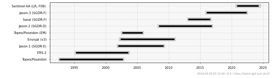
The data of the following altimeter missions and corresponding passes have been used for the estimation of the water level time series. An additional '*' indicates that an additional retracking of the altimeter measurements was performed.