
Content: General | Processing Strategy | Data Holding | Data Versions | Data Formats | Citation
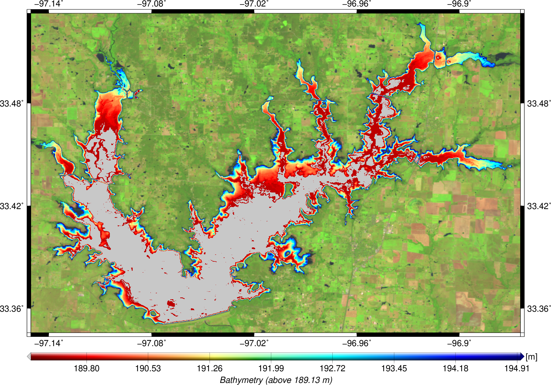
The bathymetry product is computed within the process of estimating time series of volume variations. The hypsometric curve is derived from water levels from satellite altimetry and surface areas from optical imagery. This allows us to estimate a water level for each surface area, respecively land-water based. Finally, the resulting bathymetry above minimum surface area is computed by stacking all valid land-water masks. The right figure shows the bathymetry for Ray Roberts Lake as an example. It is available for heights above 189.13m.
This product is estimated within the processing strategry of volume variations for lakes and reservoirs. Therefore, more information can be found here.
DAHITI currently provides 71 data sets of bathymetry distributed over all continents, except Antarctica. In Africa (8 data sets), Asia (9), Australia (1), Europe (4), North America (42), and South America (7) water occurrence masks are available. The bathymetry data setsin DAHITI are freely available and can be downloaded after a short registration process. The amount of bathymetry data sets is permanently increasing.
This product is estimated within the processing strategry of volume variations for lakes and reservoirs.
Therefore, more information can be found here.
The bathymetry is stored as GeoTiff. The spatial resolution is 0.0001° which is about 10m.